After more than two weeks of preparations the day of the self-organized evacuation simulation is getter closer and closer. Seven years after the worst Merapi eruption in this century, the event is meant to get the local population ready just as much as raising awareness for the challenges deriving from the thousands of rather unprepared visitors entering the area.
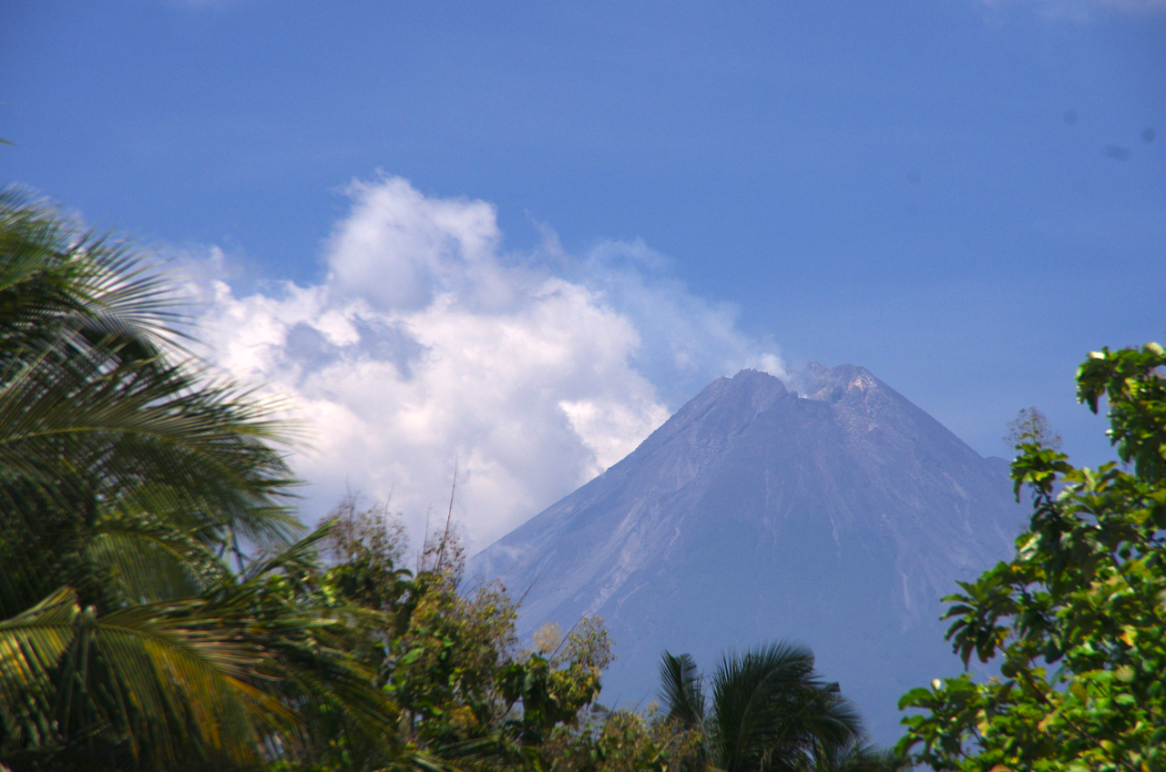
Mount Merapi: the most active of Indonesia’s 129 volcanoes.
Approximately 7 kilometers south of one of the world’s most dangerous volcanos, Pangukrejo village lies in an area classified as restricted zone (KRB III) by the Indonesian government. After 2 years of living an evacuation settlement, many community members decided to move back to their former village (as many other villages did). All that time their incomes relied on activities – mostly agriculture, cattle breeding, and tourism – in and around their old village. Although the relocation settlement already offered concrete houses, the housing units are much smaller and the narrow settlement doesn’t leave much space for extensions. The relocation site didn’t feel like home to many, because home is where they themselves, their parents and grandparents grew up. It is a place rich in stories and myth, dominated by the majestic view of the Merapi volcano.
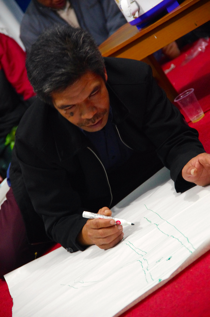
Local wisdom: members of the local community take it in turn to map out the most ideal and logical meeting points, evacuation routes and potential trouble spots by hand, based on their own intimate knowledge of their own village.
The people of Pangukrejo are not ignorant of the potential danger emanating from Merapi, and they consider the mitigation of these risks as pre-context for living in harmony with the volcano. Left in a limbo between governmental regulations regarding those living in the restricted zone and implementations on local level, the village doesn’t receive any governmental support for building essential infrastructure nor do they get trained in evacuation procedures. This is why the village have taken things into their own hands now.
In-situ simulation drill: once all key data and scenario is fixed, the coordinators, all members of the local community run a dry simulation of the evacuation scenario in-situ.
For the first time since the eruption in 2010 the village will have an evacuation training and simulation. The event is not just meant to get people prepared but also to raise public awareness for the new challenges in the area. After 2010 the area around Pangukrejo developed into a disaster-tourism hotspot, attracting tops of 2000-3000 visitor on weekends. The road infrastructure by far lacks the capacity to facilitate a smooth evacuation. An accident involving a bus or truck might even block the only evacuation road.
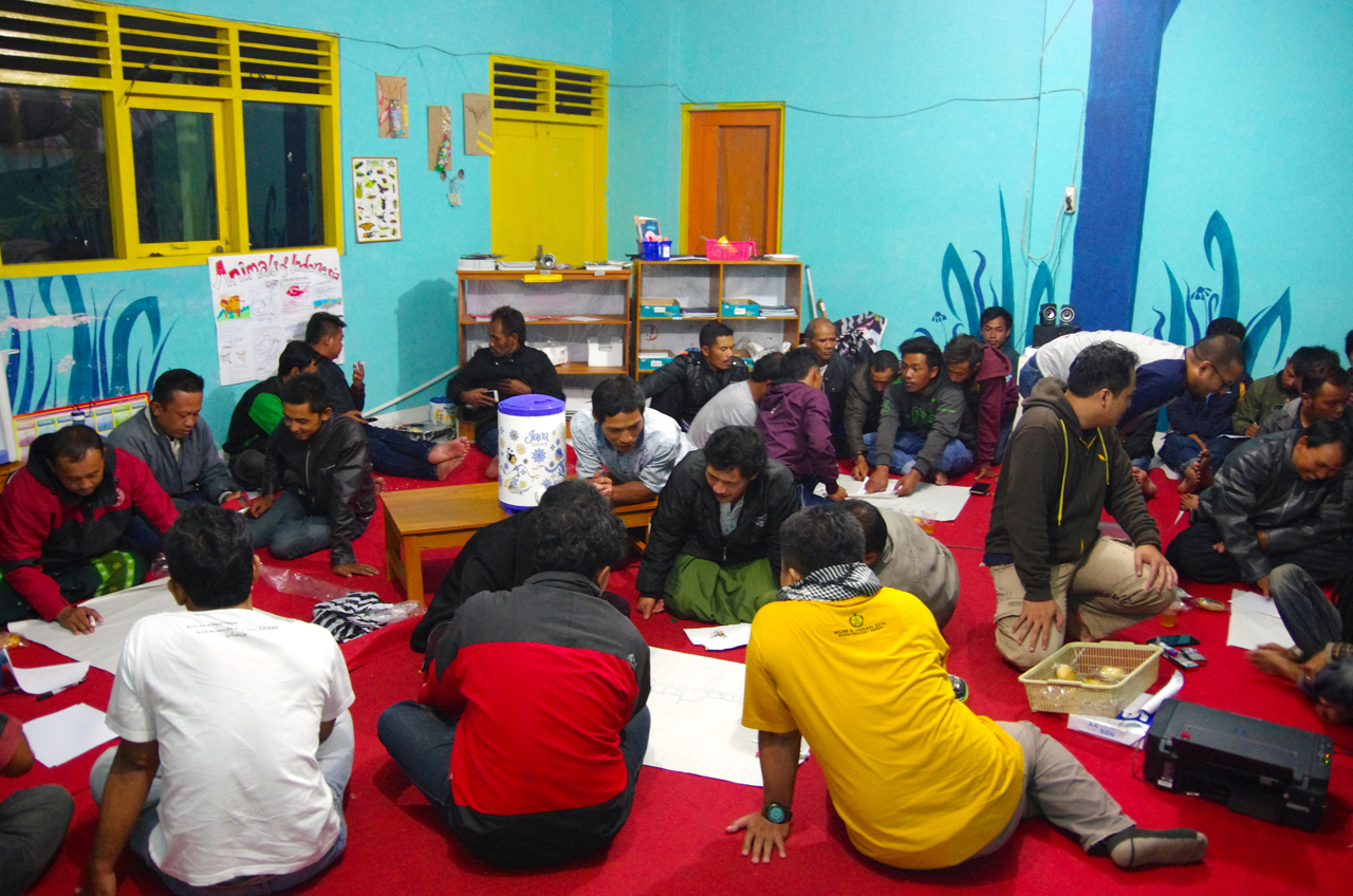
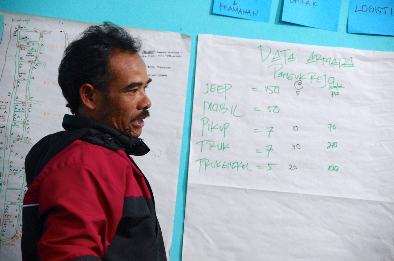
Compiling local data: asides from mapping, representatives from every household in the community work together to compile accurate data about their community such as the number of vehicles, vulnerable members of the community and animals that would have to be evacuated.
It is true that the Merapi usually shows different signs before an eruption. But the volcanic conditions changed, making phreatic eruptions more likely – and they might occur nearly without any former warnings. During this kind of eruption, the major danger doesn’t emanate from the pyroclastic flows which might travel 3 kilometers down Merapi’s slopes, but it is the panic it might generate. Many bus drivers, truck drivers or tourists on their individual vehicle are not aware of this risk nor Merapi’s different volcanic behaviors. This is something the villagers of Pangukrejo want to change in the future, because they feel responsible for the safety for every tourist entering the area. The evacuation simulation is the first step, operational procedures and clear responsibilities planning will follow.

A life in pink: this map show the areas most at risk of primary volcanic damage during a magmic eruption. This village’s location in the KRB III means it is not entitled to many forms of government support, including disaster management and mitigation strategies. This sterile policy, intended to reduce risks by encouraging relocation, has instead made this community more vulnerable to disaster.
If you are from the media and you are staying in or around Yogyakarta, feel welcome to join the press conference and event at Huntap Plosokerep after the simulation (Sunday, 5th November; 9:00 am). The more public awareness we raise, the better.
******************************
Mag. Karl Markus Valent
PhD Candidate
Department of Social and Cultural Anthropology
University of Vienna
Universitätsstrasse 7, 4th floor (NIG)
A-1010 Vienna
Mobile Austria: +43 681 8194 0449 (also WhatsApp)
Mobile Indonesia: +62 877 4209 2255
")
")